
Uncover the Most Dangerous Highways in California for 2026
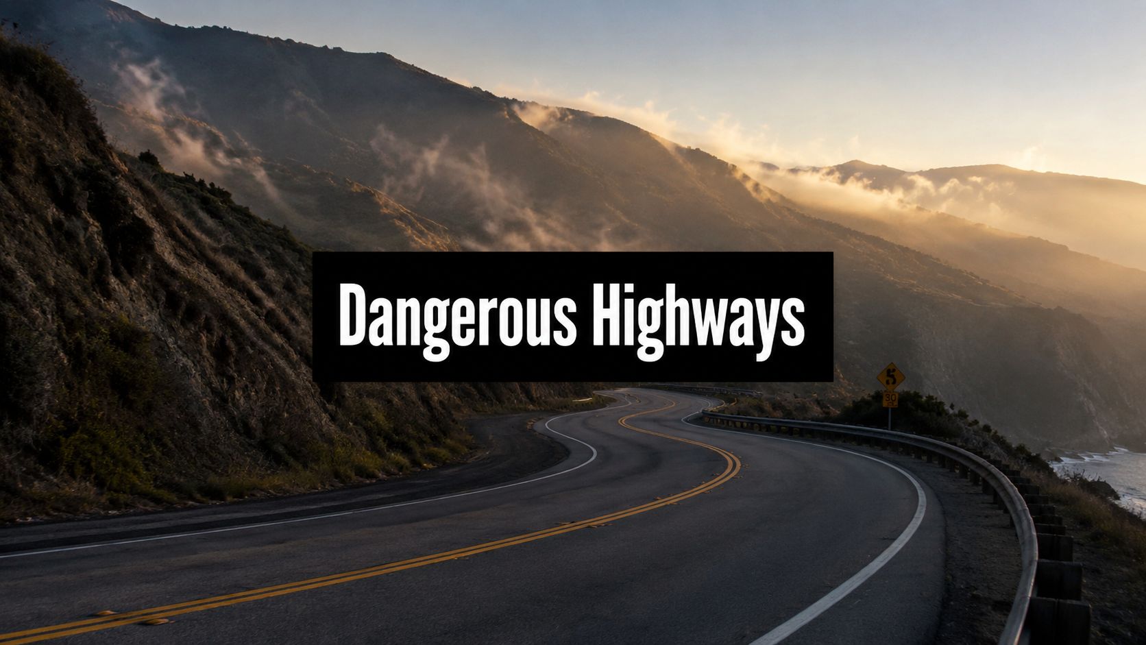
Some California highways punish small mistakes fast.
The risk is not spread evenly across the state. A packed Los Angeles freeway creates one set of dangers. A mountain pass in snow, fog, or darkness creates another. A Central Valley corridor with heavy truck traffic creates another. If you drive on these roads regularly, broad statewide rankings will not help much. You need to know where crashes keep happening, what driver behavior makes them worse, and what specific habits reduce your odds of getting hurt.
That is the point of this guide. It goes beyond a top-10 list by focusing on local crash patterns, stretch-by-stretch safety advice, and the legal steps that protect you after a wreck. LA Law Group’s perspective is simple. The first hour after a highway crash can shape both your medical recovery and your injury claim. If another driver causes the collision, follow a clear post-accident checklist for protecting your health and claim before memories fade, vehicles move, and insurers start building their defense.
Each section below explains why a specific road is dangerous, what conditions make it worse, and what to do differently when you are behind the wheel there. Urban congestion, mountain grades, rural two-lane highways, and freight-heavy corridors call for different decisions. Treat them that way.
This article is for informational purposes only and does not create an attorney-client relationship. Nothing in this article is legal advice.
1. Interstate 5 (I-5) Through Los Angeles County
Interstate 5 is dangerous because drivers stack bad habits on top of dense traffic. Fast lane changes, abrupt braking, late merges, and distraction turn routine congestion into chain-reaction crashes. In California, I-5 recorded 128 deaths in 2022, making it the state’s deadliest highway by total fatalities, and Los Angeles County had the highest number of deadly accidents statewide, with speeding and drunk driving identified as the primary contributing factors in Panish Shea Ravipudi LLP’s review of California’s deadliest highway stretches.
In the Los Angeles County segment, the legal issue after a crash is often fault allocation. Rear-end impacts may look simple, but multi-vehicle freeway collisions rarely are. One unsafe lane change can trigger a pileup several cars back.
How to drive this stretch better
Keep more space than feels necessary. A three to four second following distance gives you room to react when traffic compresses suddenly near interchanges, ramps, or stalled vehicles.
- Avoid the worst windows: If you can, stay off this corridor during peak rush periods.
- Signal early: Give drivers around you time to respond before you move.
- Slow down in fog: Use low-beam headlights and make yourself visible.
- Watch the shoulder: Debris, disabled cars, and emergency responders appear fast on I-5.
Practical rule: If traffic feels unstable, your following distance is too short.
If a collision happens, get to a safe shoulder if your vehicle can move, call law enforcement, and start following the steps outlined in what to do after a car accident. That protects both your safety and your claim.
2. Highway 101 (US Route 101) Ventura County Section
US Route 101 through Ventura County doesn’t usually scare drivers the way a mountain pass does. That’s exactly why it catches people off guard. Coastal weather shifts quickly, visibility can collapse, and wet pavement punishes overconfidence.
A common crash pattern here is the commuter who starts in clear conditions and drives into fog or rain without changing speed, spacing, or lane discipline. Tourist traffic adds another problem. Unfamiliar drivers hesitate, brake late, and make abrupt exits.
What drivers get wrong on 101
Drivers often wait too long to adjust. They keep cruise speed in fog, trust their tires in early rain, and follow too closely when visibility drops.
Use these habits instead:
- Reduce speed in fog: If visibility drops sharply, back off speed and use low beams.
- Create a weather buffer: In wet conditions, increase your following distance substantially.
- Turn off cruise control: Wet pavement requires active speed control.
- Check conditions before leaving: Ventura County weather can change between inland and coastal sections in one trip.
- Expect sudden transitions: A clear start doesn’t mean a clear drive.
Fog isn’t just a visibility problem. It shortens decision time, and that’s what causes impact.
If another driver hydroplanes into you or rear-ends you in reduced visibility, don’t let the insurance carrier frame the crash as unavoidable weather. Weather doesn’t excuse careless speed, poor following distance, or unsafe lane changes.
3. Interstate 80 (I-80) Sierra Nevada Mountain Passes
I-80 through the Sierra demands respect every mile. Snow, chain controls, freezing temperatures, long descents, truck traffic, and driver fatigue all converge in a corridor where small mistakes become major crashes quickly.

A typical scenario is simple. A driver leaves the valley in normal conditions, reaches elevation, and discovers that tires, brakes, wipers, and visibility are no longer good enough. By then, options are limited.
Mountain-pass discipline
Check road advisories before you leave. If chains are required, don’t wait until conditions worsen. Install them early and correctly on the proper drive wheels.
- Use lower gears on descents: Don’t rely on constant braking.
- Leave extra room behind trucks: A long downgrade changes stopping dynamics fast.
- Rest before climbing: Drowsy drivers drift, especially in snow glare and long night drives.
- Carry basics: Water, blankets, a flashlight, jumper cables, and traction material matter on remote winter roads.
Many drivers benefit from watching road-condition footage before the trip because it resets expectations. This pass can go from manageable to hostile very quickly.
A quick visual reference helps:
If you’re hit here, preserve photos of chain conditions, shoulder conditions, weather, and any truck involvement. In mountain crashes, those details often decide liability.
4. Highway 99 (California State Route 99) Central Valley Segments
Highway 99 stands out for one reason. It stacks everyday traffic hazards on top of poor visibility, fast-moving vehicles, and constant conflict with commercial and agricultural traffic. In the Central Valley, that combination turns routine driving mistakes into serious crashes.
This road demands more discipline than drivers usually give it. Long straight stretches create overconfidence. Then the conditions change fast. Dust reduces contrast, glare wipes out depth perception, trucks block sight lines, and slower vehicles appear with little warning. If you want a broader sense of how often these patterns lead to severe collisions statewide, review these California car crash statistics and roadway risk trends.
Why Central Valley segments of 99 produce hard crashes
The danger on 99 is not just speed. It is speed mixed with limited reaction time.
Drivers on this corridor regularly face a bad set of variables at once: fading light, uneven illumination, lane changes around trucks, farm vehicles entering traffic, and abrupt slowdowns near interchanges and local access points. Rear-end crashes, sideswipes, underride collisions, and high-speed lane-change wrecks all make sense here because the road keeps forcing drivers to process more than they expect.
Use a stricter routine on Highway 99:
- Slow down before visibility gets bad: If you see dust, haze, smoke, or glare ahead, reduce speed early.
- Do not crowd trucks: They hide traffic conditions in front of you and need more room to stop.
- Treat farm traffic as unpredictable: Expect wide turns, slow acceleration, and sudden crossings near rural access roads.
- Keep your lights fully functional: Headlights, brake lights, and turn signals matter more on a corridor where contrast drops fast.
- Pass only with clear sight lines: Do not force a move near ramps, merging areas, or narrow shoulders.
One mistake here often triggers a chain-reaction crash.
From a legal standpoint, Highway 99 cases usually turn on details drivers overlook at the scene. LA Law Group would tell you to document lighting conditions, skid marks, truck markings, cargo information, nearby field access roads, and any obstructed signs or signals right away. If a commercial vehicle, farm operator, or road-condition issue played a role, that evidence can decide who pays and how much your case is worth.
If you are injured on Highway 99, do not settle for the basic police summary. Get photos of the roadway, the shoulder, vehicle positions, and the visibility conditions at the time of the crash. On this road, those facts often make the liability case.
5. Interstate 10 (I-10) Los Angeles to San Bernardino County
I-10 creates risk through pressure. Drivers rush, brake hard, tailgate, and treat every opening like a challenge. In heat, congestion, and long suburban stretches, that behavior leads to rear-end crashes, sideswipes, and loss-of-control collisions.
This isn’t a road for aggressive driving. It’s a road for patience and vehicle discipline. Tires, brakes, and cooling systems all matter more when traffic alternates between standstill and highway speed.
Smart habits for the I-10 corridor
Keep your spacing steady instead of reacting emotionally to every merge. Smooth inputs prevent the kinds of collisions that start with one impatient lane change and end with three damaged vehicles.
- Use a wider buffer on downgrades: More following distance means more reaction time.
- Avoid sharp acceleration and braking: Sudden inputs create instability behind you.
- Inspect tires before long drives: Heat and poor inflation increase failure risk.
- Use lower gears on significant descents: Riding the brakes is a mistake.
- Report dangerous drivers: If someone is weaving or threatening others, contact CHP when it’s safe.
For a broader context on statewide roadway risk patterns, review California car crash statistics and the risks on California’s roads. If a crash happens on I-10, immediate documentation matters because insurers often argue that congestion made the collision unavoidable. That’s often false.
6. Highway 46 (California State Route 46) San Luis Obispo County
Highway 46 is a rural road that demands urban-level attention. The danger isn’t only speed. It’s limited visibility, narrow recovery space, curve judgment, and drivers who think open country means open permission.

A common serious crash on Highway 46 starts with a bad pass. One driver gets impatient behind slower traffic, moves left without a clear sight line, and leaves everyone else with seconds to react.
Defensive driving on a two-lane fatal corridor
Your lane position matters here. So does your patience. Stay centered on curves and don’t drift toward the middle line just because the roadway feels open.
- Obey posted speeds: Curve warnings on rural highways aren’t suggestions.
- Pass only with a clear view: If you can’t clearly see oncoming traffic far ahead, don’t go.
- Use headlights all day: Visibility matters for oncoming drivers too.
- Slow at dawn and dusk: Wildlife and low-angle light reduce your margin.
- Let aggressive drivers go: Pull off safely when needed and remove yourself from their problem.
If you’re injured in a head-on or crossover crash on Highway 46, get roadway photos quickly. Skid marks, gouge points, shoulder width, and sight obstructions can become critical evidence.
7. Interstate 5 (I-5) Grapevine Grade and Kern County Section
The Grapevine is one of those stretches every California driver knows by name, but familiarity doesn’t make it safer. Steep grades, fast-changing weather, heavy truck traffic, and disabled vehicles turn this corridor into a high-consequence driving environment.

The danger here isn’t only whether you control your own car. It’s whether the vehicles around you, especially commercial trucks, are operating within their limits.
What keeps you safer on the Grapevine
Downhill driving starts before the downgrade. If your brakes already feel hot or weak, you’re late. Shift lower early and let the engine help manage speed.
- Give trucks real room: They need longer stopping distances and wider operating space.
- Watch for debris: Tire fragments, cargo loss, and disabled vehicles are common hazards.
- Brace for wind near the summit: Sudden gusts can move lighter vehicles.
- Exit immediately if brakes fade: Shoulder safety beats rolling failure.
- Stay patient uphill: Tailgating trucks on climbs serves no purpose.
In injury cases here, truck maintenance, brake condition, driver logs, and load security often matter. If a commercial vehicle is involved, preserve as much identifying information as you can.
8. Highway 138 (California State Route 138) San Gabriel Mountains
Highway 138 combines mountain driving with limited forgiveness. Sharp curves, changing elevation, narrow margins, and occasional truck traffic create a road where entering a curve too fast is enough to end the trip badly.
That makes speed selection the central issue. Not posted speed. Safe entry speed. Those aren’t always the same thing, especially in poor weather or unfamiliar terrain.
Curve management that prevents crashes
Brake before the curve, not inside it. Enter slower than you think you need to, then accelerate only when you can see the exit and hold your lane.
- Use low gear on descents: Protect your brakes for the next hazard.
- Increase following distance: Tailgating on curves leaves no escape path.
- Expect lane drift from others: Some drivers cut curves or panic-brake mid-turn.
- Check weather before you go: Mountain conditions can shift quickly.
- Know truck risks: Large-vehicle movement and stopping limits matter on this route.
If this is part of your regular drive, it helps to understand six common causes of commercial trucking accidents and how to protect your rights. Commercial vehicle crashes on mountain corridors raise different liability issues than ordinary passenger-car claims.
Enter every mountain curve at a speed that leaves you one good option, staying in your lane.
9. Interstate 15 (I-15) San Diego County Section and Cajon Pass
I-15 deserves serious attention from both drivers and injury lawyers. Interstate 15 in San Bernardino County was identified as America’s deadliest highway by fatal crash density, recording 80 fatal crashes over a three-year period, and the most hazardous segment lies between Exits 138 and 129 in Hesperia, according to Victims Lawyer’s California crash statistics review.
Another review found that the same I-15 stretch between Exit 138 and Exit 129 recorded 48 fatalities in 2022, with 22 of those deaths directly caused by speeding, as explained in MoneyGeek’s analysis of California’s deadliest roads. Those aren’t abstract numbers. They reflect what drivers see in real time on this corridor: excessive speed, long distances, heavy traffic, and dangerous behavior around grades.
What to do in the Cajon Pass and beyond
Descending traffic makes people overconfident. That’s when brake misuse, late passing, and truck-related hazards show up.
- Stay in lower gear on downgrades: Continuous brake riding creates fade.
- Leave trucks more room than normal: Especially on descent.
- Don’t force a pass downhill: Passing a truck in a downgrade section can remove your escape space.
- React fast to brake fade: Reduced response means get slower and get safe.
- Report obvious mechanical distress: Smoking wheels and dragging components are warning signs.
If you’re struck by a speeding driver or commercial vehicle on I-15, get the police report, witness names, and scene photos immediately. This corridor often produces hard-fought liability disputes.
10. Highway 299 (California State Route 299) Trinity County Mountain Crossing
Highway 299 is remote, winding, and unforgiving. Drivers often underestimate it because traffic volume feels light. That’s the wrong way to assess danger. Isolation, steep curves, limited visibility, and slower emergency response make mistakes here more costly.
This is the kind of road where local drivers may move confidently while visitors rely too heavily on GPS timing. GPS doesn’t feel the curve radius, shoulder drop-off, or lack of immediate services. Your own judgment has to override the app.
How to drive a remote mountain crossing
Slow down early and accept the pace of the road. On many curves, the safe speed is far lower than what drivers use on ordinary highways.
- Use headlights the entire time: You want to be seen before you’re fully visible.
- Don’t gamble on passes: Limited sight lines make passing a high-risk choice.
- Expect slow vehicles: Forest service equipment and cautious drivers are part of the route.
- Carry supplies: Water, blankets, first aid gear, and a charger matter where service is limited.
- Avoid solo travel if possible: Remote sections are easier to manage with another person.
If a crash happens here, preserve every piece of evidence you can before vehicles are moved or weather changes the scene. Remote-road cases can become evidence-poor very quickly.
Comparison of Californias 10 Most Dangerous Highways
| Segment | Primary Hazards 🔄 | Mitigation Complexity 🔄 | Resource Requirements ⚡ | Expected Safety Impact 📊 ⭐ | Ideal Interventions & Tips 💡 |
|---|---|---|---|---|---|
| Interstate 5 (I-5), Los Angeles County | Aggressive lane changes, tailgating, multi-vehicle pile-ups, debris, fog | High, complex urban interchanges and mixed traffic patterns | High, ITS, ramp metering, enforcement, lane reconfigurations | Moderate impact (3/5 ⭐), improvements possible but constrained by demand; ~3,500 accidents/yr, ~18 fatalities/yr | Expand ITS & enforcement, public outreach, avoid peak hours, maintain 3–4s following distance |
| Highway 101, Ventura County | Fog banks, hydroplaning, narrow shoulders, wildlife, close ramps | Moderate, weather-driven hazards with geometry constraints | Moderate, weather sensors, drainage, signage, shoulder improvements | Moderate impact (3/5 ⭐), weather interventions reduce incidents; ~200+ weather-related accidents/yr | Reduce speed in fog, use low beams, avoid cruise control, check forecasts before travel |
| Interstate 80 (I-80), Sierra Nevada | Black ice, whiteouts, brake failure, avalanches, long downgrades | High, seasonal controls, avalanche mitigation, chain enforcement | High, snow removal, avalanche control, chain inspection, rest areas | High impact (4/5 ⭐), strict winter measures markedly lower risk; 200–300 winter accidents/yr | Enforce chain laws, use winter tires, lower gears on descents, check advisories before travel |
| Highway 99, Central Valley | Dust storms, high-speed collisions, agricultural vehicle interactions, debris | Moderate, rural geometry and agricultural interactions complicate interventions | Moderate, medians/passing lanes, turnouts, signage, targeted enforcement | Moderate impact (3/5 ⭐), targeted infrastructure & enforcement cut severe crashes; dust causes 15–20% serious crashes seasonally | Slow for dust, increase following distance, cautious passing, avoid peak dust season |
| Interstate 10 (I-10), LA to San Bernardino | Aggressive driving, brake failure on downgrades, smog-reduced visibility | High, urban congestion plus steep grade management | High, traffic management, enforcement, vehicle inspection, public alerts | Moderate impact (3/5 ⭐), enforcement and vehicle prep help; ~4,000 accidents/yr, ~16 fatalities/yr | Use lower gears on downgrades, check tires, avoid peak hours, maintain 3–5s following distance |
| Highway 46, San Luis Obispo County | Head-on collisions, illegal passing, blind curves, minimal shoulders | Moderate, expensive geometry fixes; targeted enforcement achievable | Moderate, barriers, passing zones, lighting, aggressive-driving enforcement | Moderate impact (3/5 ⭐), speed control and enforcement reduce fatal head-on crashes; ~7 fatalities/yr | Obey speed limits, never pass on limited sight, headlights on, report illegal racing |
| Interstate 5 (I-5), Grapevine Grade & Kern | Truck brake failure, jack-knifing, cargo spills, sudden weather | High, truck-specific controls and steep-grade management required | High, truck inspections, runaway ramps, signage, carrier enforcement | High impact (4/5 ⭐), truck-focused measures significantly reduce severe incidents; truck incidents ~45% of serious crashes | Use low gears, maintain large gaps behind trucks, check advisories, report mechanical issues |
| Highway 138, San Gabriel Mountains | Loss of control on sharp curves, narrow lanes, brake failure, run-off-road | Moderate–High, curve geometry costly to change; signage and enforcement effective | Moderate, guardrails, curve warning systems, enforcement, public education | Moderate impact (3/5 ⭐), speed reduction and signage lower loss-of-control crashes; loss-of-control ~70% of fatal crashes | Slow well before curves, use low gear, increase following distance, consider mountain driving training |
| Interstate 15 (I-15), San Diego & Cajon Pass | Truck brake failure, brake fade on long downgrades, excessive speeds | High, requires truck safety programs and downgrade controls | High, truck ramps, inspections, enforcement, advisory systems | High impact (4/5 ⭐), focused truck & grading measures reduce severe collisions; Cajon Pass truck incidents 35–40% | Use lower gears, do not ride brakes, use runaway ramps if needed, keep distance behind trucks |
| Highway 299, Trinity County | Head-on collisions, loss of control on tight curves, delayed emergency response | Moderate, remote location limits solutions; signage and response improvements help | Moderate, curve warnings, passing restrictions, improved emergency access | Lower but critical impact (2/5 ⭐), interventions help but remoteness limits outcomes; high fatality rate per VMT | Significantly reduce speed, travel prepared with supplies, use headlights, avoid solo travel at night |
Your Legal Rights After a Highway Accident
Even the most cautious drivers can become victims on California’s dangerous highways. The first priority is safety and medical care. Get yourself and others out of active traffic if possible, call 911, and accept medical evaluation when there’s any chance of injury. Adrenaline masks symptoms, and delayed treatment gives insurance carriers an opening to argue that you weren’t hurt in the crash.
Once you’re safe, document the scene. Take photos of vehicle positions, damage, skid marks, debris, weather, lighting, lane markings, and visible injuries. Get witness names and contact information. Ask responding officers how to obtain the traffic collision report. If a commercial truck is involved, capture company markings, USDOT numbers, trailer identifiers, and the driver’s information.
California injury claims move on evidence. That means the hours after a crash matter. A bad statement to the other driver’s insurer can hurt you. So can a long delay in treatment, incomplete photos, or a failure to identify independent witnesses. If road design, lighting, weather, cargo loss, or brake failure played a role, your lawyer needs to investigate early before records disappear and memories fade.
In California, you generally have two years from the date of the injury to file a personal injury lawsuit. Don’t treat that as extra time to wait. Strong cases are built early, while vehicles can still be inspected and data can still be preserved. This is especially important in crashes involving commercial trucks, dangerous mountain grades, multi-vehicle freeway collisions, or road-condition disputes.
An experienced personal injury attorney from LA Law Group can protect your rights, handle communication with insurance adjusters, investigate the crash to establish fault, and fight to secure the maximum compensation you deserve for medical bills, lost wages, and pain and suffering. If a drunk driver, speeding driver, trucking company, or other negligent party caused the collision, your claim should reflect the full scope of what you’ve lost, not just what an insurer wants to pay quickly.
You should also understand your coverage issues, including essential auto liability for accidental damage, because insurance structure can affect how property and injury claims unfold after a serious crash.
Contact us for a free consultation to understand your legal options.
This article is for informational purposes and not to be construed as legal advice. No attorney client relationship exists based on the review of this this article and none of the information in this article is legal advice.
If you’ve been injured on one of the most dangerous highways in California, contact LA Law Group, APLC. The firm provides direct attorney access, free initial consultations, and representation focused on protecting your health, your evidence, and your financial recovery after a serious crash.
Attorney Advertising. This article is general information, not legal advice, and does not create an attorney-client relationship. Prior results do not guarantee a similar outcome.